


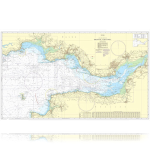
Standard Nautical Charts
Standard nautical charts are the most trusted and widely used official paper charts in the world.
The range includes extensive paper coverage of commercial shipping lanes, ports and harbors to help bridge crews navigate safely in accordance with SOLAS regulations.
- Port Approaches Guide
- Routeing Charts
- Maritime Security Planning Charts
- Mariners Routeing Charts
- Reference and Plotting Charts
- Leisure Charts
Commercial and Recreational Nautical Charts
We offer the best in nautical charts for commercial and recreational boaters, from NOAA charts to those used for hurricane tracking.
NOAA Charts for U.S. Waters
NOAA Bathymetric Charts by OceanGrafix
Historical Charts from OceanGrafix
Hurricane Charts by OceanGrafix
NGA Charts for International Waters
CHS Charts for Canadian Waters
NHS Charts for Norwegian Coastal Waters
IMRAY Charts for Caribbean Waters
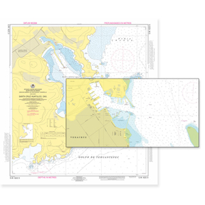
Nautical charts in Mexican marine areas
Nautical charts with coverage of the main Mexican marine areas with information issued by the Secretary of the Navy, are divided into 4 chapters:
CHAPTER I: General Charts of the Pacific Ocean, Gulf of Mexico and the Caribbean Sea;
CHAPTER II Coastal Charts, Approach, Portulans and Mooring of the Pacific Ocean;
CHAPTER III Coastal Charts, Approach, Portulans and Mooring of the Gulf of Mexico and the Caribbean Sea;
CHAPTER IV Electronic Nautical Charts S-57: Pacific Ocean, Gulf of Mexico and Caribbean Sea.